 A
project of the Angeles Chapter of the Sierra Club:
A
project of the Angeles Chapter of the Sierra Club:Verdugo Hills Group
GIS Committee
A
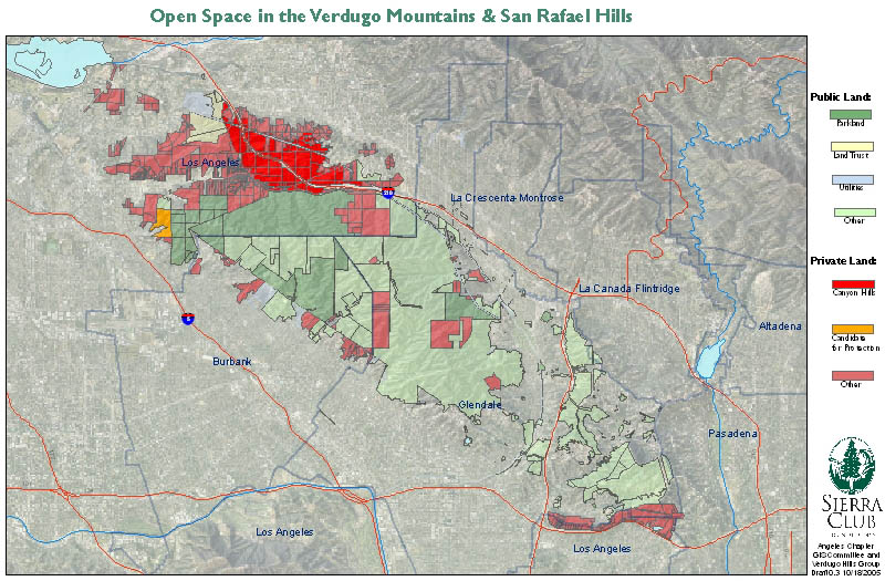
project of the Angeles Chapter of the Sierra Club:Our vision for the future land-use in the Verdugo Mountains and San Rafael Hills is that all the undeveloped land should become parkland. The purpose of this project is to identify properties that can be saved as open space via purchase by a public entity or conservation organization, or via conservation easement.
The map is complete, and JPEG images of it can be found on the Sierra Club Angeles Chapter's GIS Committee's library page.
Here is a low-resolution version of the Oct, 2005 version of the map (V0.3):
A higher-resolution tabloid-sized PDF is also available, but it's a big file (32 Mb).
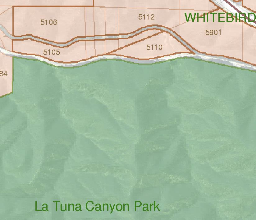
Our printed map is much larger still - 36" X 60". It has ID numbers on the larger (>4 acres) parcels. Here is a portion from the center of the high-resolution map, showing the level of detail:
We also have an Excel spreadsheet that serves as a catalog of the private parcels. A lot of the APN and ownership information still needs to be filled in.
A similar project, with a larger scope, was undertaken in the 1970's by the local chapter of Small Wilderness Area Preservation (SWAP), resulting in a document entitled Verdugo-San Rafael Urban Mountain Park (4Mb .pdf file).